Services

Drawings, models, and checks from one scan.

From a single point cloud we produce the record the project actually needs. Pick one deliverable, or several from the same capture.

Six deliverables Millimetre accuracy Your project's formats
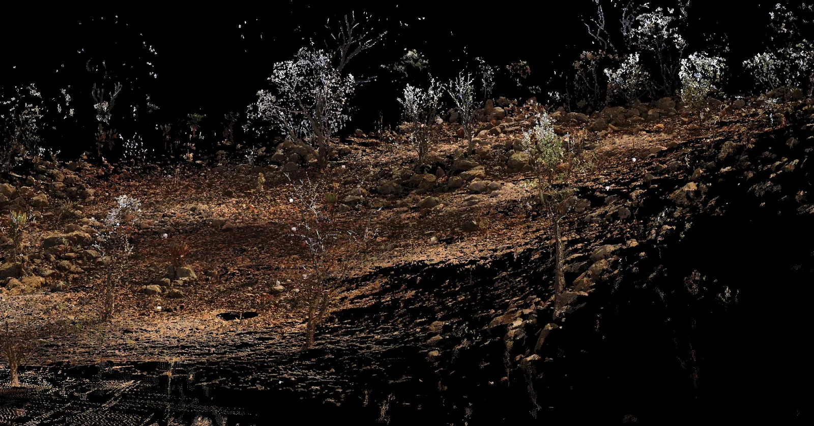
Point cloud of rocky, vegetated terrain S / 01
Service 01

Topographical surveys

Accurate drawings that identify both the natural and the man-made features inside a specified area, including ground falls that are slow to pick up by hand.

  • Natural and man-made features in one capture
  • Ground falls and levels across the area
  • Drawings produced from the point cloud
Discuss this service → Service page → Opens the shared service template
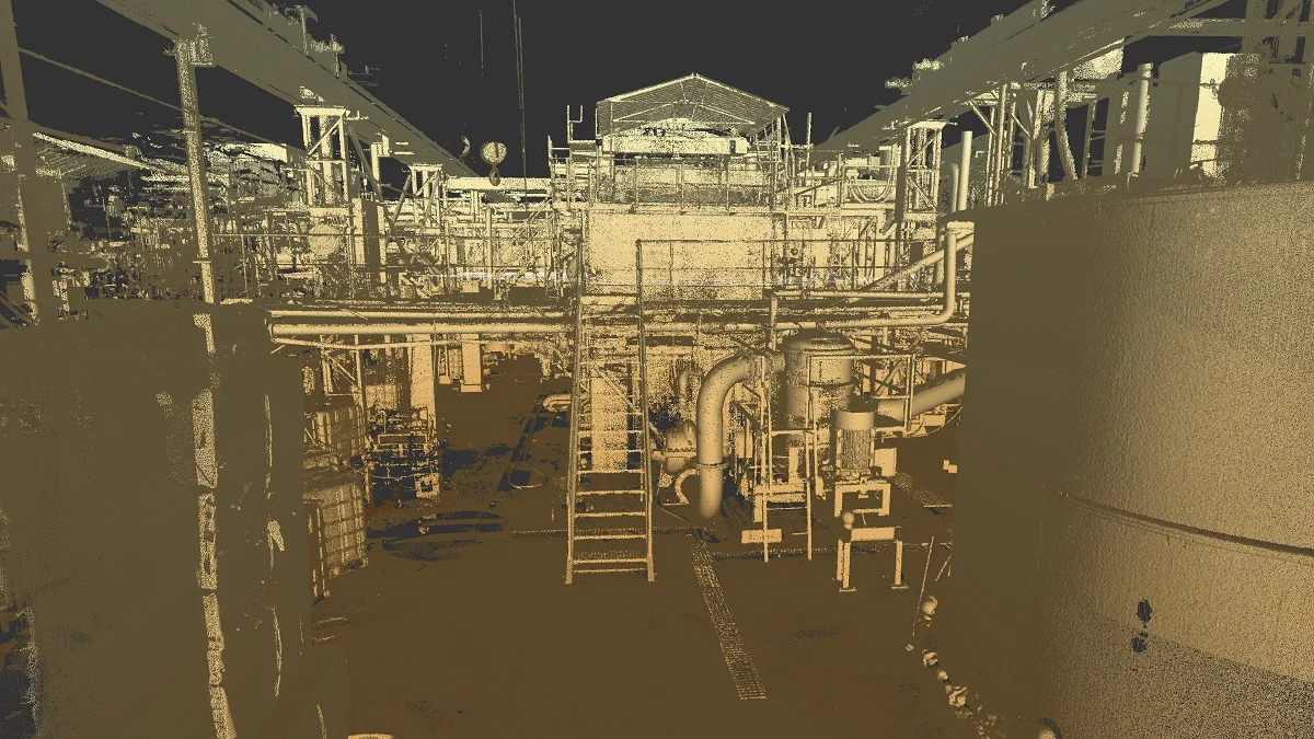
Point cloud of an industrial plant with pipework and stairs S / 02
Service 02

Clash detection

The conflicts between a project model and the as-built environment, identified, assessed, and reported before they become rework on site.

  • Design model compared with the existing site
  • Clashes identified and assessed
  • A report the team can act on
Discuss this service → Service page → Opens the shared service template
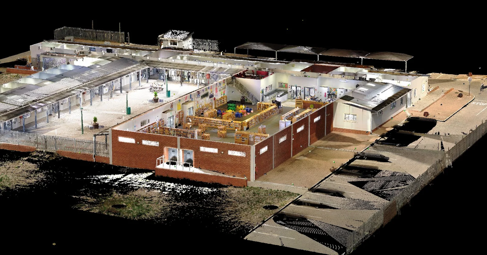
Colour point cloud of a school building with the roof removed S / 03
Service 03

Space planning surveys

Accurate information on the structure, so areas can be assessed for planning without a tape measure and a second visit.

  • Areas and structure measured in one visit
  • Hard-to-reach areas included
  • A record for planning and redesign
Discuss this service → Service page → Opens the shared service template
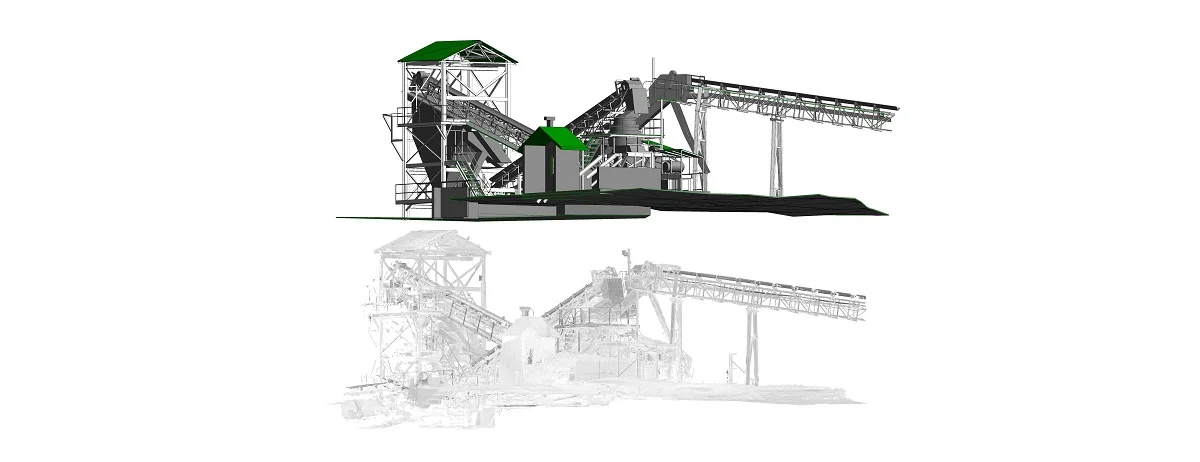
Design model of a conveyor plant shown above its matching point cloud S / 04
Service 04

Construction verification

The physical construction checked against the design model. The model and the point cloud are overlaid, so the difference is visible rather than estimated.

  • Point cloud overlaid on the design model
  • Deviations made visible
  • A check during the build, not after it
Discuss this service → Service page → Opens the shared service template
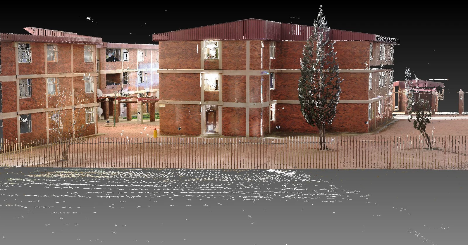
Registered colour point cloud of brick school buildings S / 05
Service 05

Registered point cloud

The registered model on its own, for clients who draught their own drawings from point cloud data and do not need us to model it.

  • Individual scans registered into one cloud
  • Variance tolerance report on request
  • Ready for your team's own software
Discuss this service → Service page → Opens the shared service template
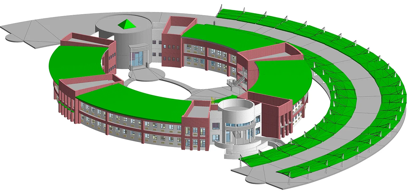
3D as-built model of a curved, multi-storey campus building S / 06
Service 06

As-built surveys

3D models and 2D plans of the building as it stands, with the level of detail set to the project rather than to a default.

  • 3D model of the existing space
  • 2D plans drawn from the model
  • Level of detail matched to the work

How it works

Every service runs the same four steps.

The capture is only useful once it is registered, drawn, and handed over in a format the project can open.

01

Scan

A high-definition survey of the space, including areas that are hard to reach, without closing the site.

02

Register

The scans are tied into one point cloud, with a variance tolerance report available on request.

03

Model

3D models and 2D plans at the level of detail required, or an overlay with your design model.

04

Deliver

Exports in the formats the project already uses, or the registered cloud for in-house teams.

Start a project

Tell us about the site.

A short note on the building, the deliverable you need, and where it is. We will come back with an approach and a quote.